
Just as Wisconsin is warming up to the idea of spring my co-worker Angela and I decided to take a photo excursion trip to Door County, Wisconsin and photograph winterscapes before they were gone. As I’m sure most of you have experienced, winter in Wisconsin this year was particularly brutal. In the fox cities we had 54 consecutive days where temperatures were below freezing. That beats the record held in 1976 of 48 days. I think I even heard that 90% of the Great Lakes froze over, another record that hasn’t happened since the 70’s. While winter can be a long and dreary season, there is a lot of beauty in winter that I think is easy to overlook.
We drove to Sturgeon Bay on a Friday right after work and got checked into our hotel. Our goal was to do this trip as cost-effective as possible so we went with a cheaper hotel, which in the end was riddled with problems and issues, but we really only needed a bed to sleep in so I suppose it served it’s purpose. 🙂 After check in we immediately drove to Cave Point County Park to scope out the scene and get a good idea of what we were in for in the morning. We walked around the park for a bit and snapped a few iPhone photos to remember key locations to photograph. Then we headed back to the hotel and lounge around before we decided to hit the hay. I had a hard time falling asleep because I was so excited to begin our adventure. I don’t think I fell asleep until after midnight.
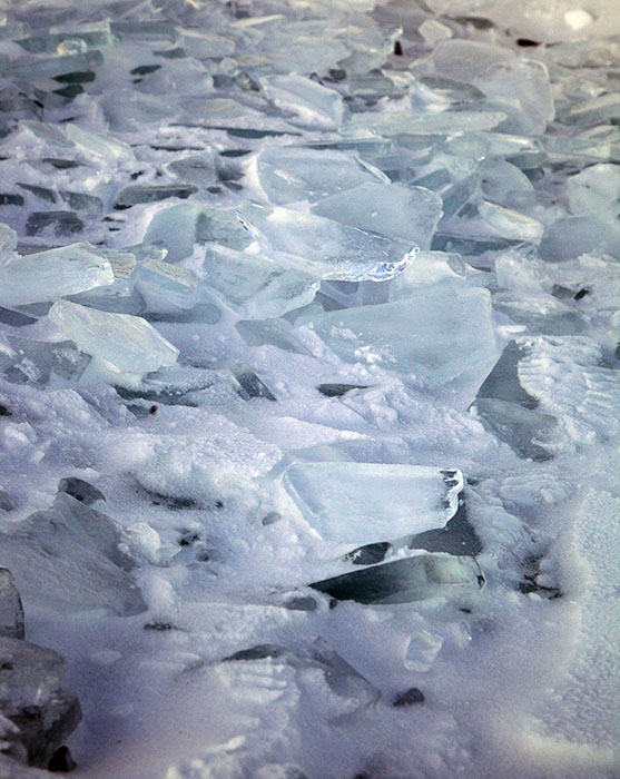
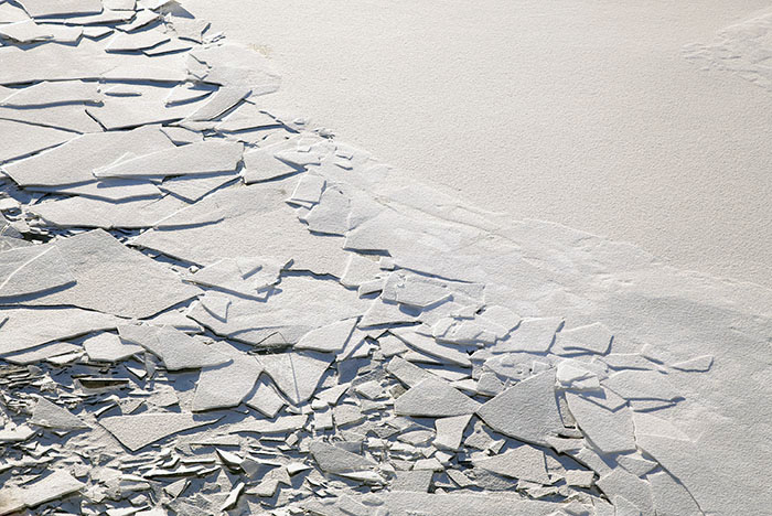
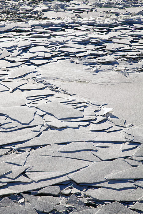
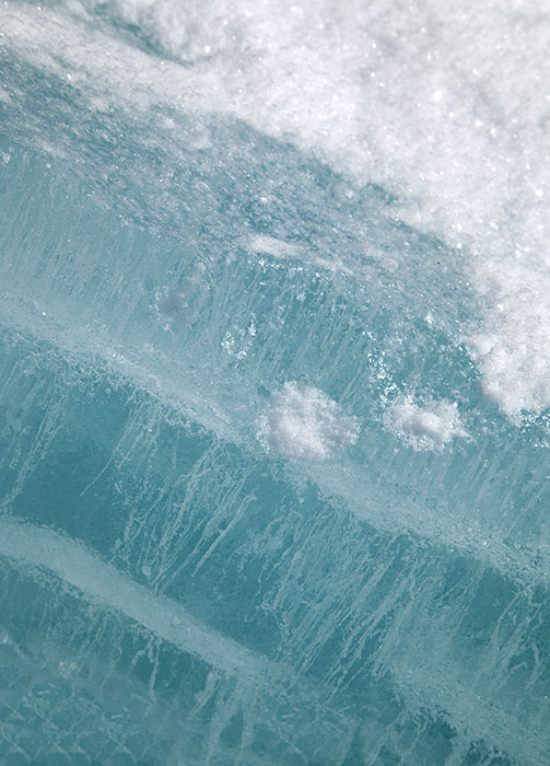
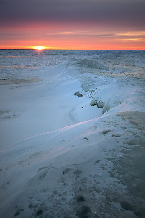
Up at 4am and quickly out the door again headed to Cave Point to get set up for the sunrise. Cave point is on the lake side of Wisconsin’s upper peninsula. There were loads of beautiful glistening ice shoves and plates along the shoreline. The ice shoves were an incredible glacier blue in color, which is caused by the type of sediments in the water. The ice freezes in layers, and fewer air bubbles in the ice creates deeper blue tones. Since we had scoped out the park the evening before I knew exactly where I wanted to set up for the sunrise. The shoreline was covered in ice and the further out you went the rougher the terrain. I’m not certain but I believe that the waves would gradually freeze and create these tall ice bluffs. At the edge of these bluffs were the ice shoves and plates, just beyond those was open water. I was surprised to see open water considering the amount of ice coverage reported. I didn’t feel comfortable going any further than the ice bluffs so I set up my gear and waited for about an hour and a half for the sun to come up over the horizon. The wind was brutal, and was constantly bombarding me with tiny granules of snow and ice. I had dressed appropriately, but the wind still managed to find ways to sneak through my clothes. Sunrise was incredible. I photographed the area for a while and then headed back up to the rocky limestone cliffs. There is also a gorge at the park where the water has worn away the limestone. This area was also frozen over with what seemed like thousands of jagged icicles.
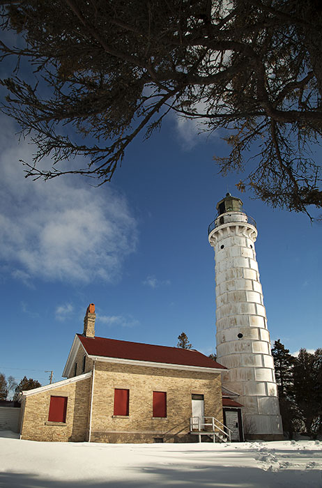
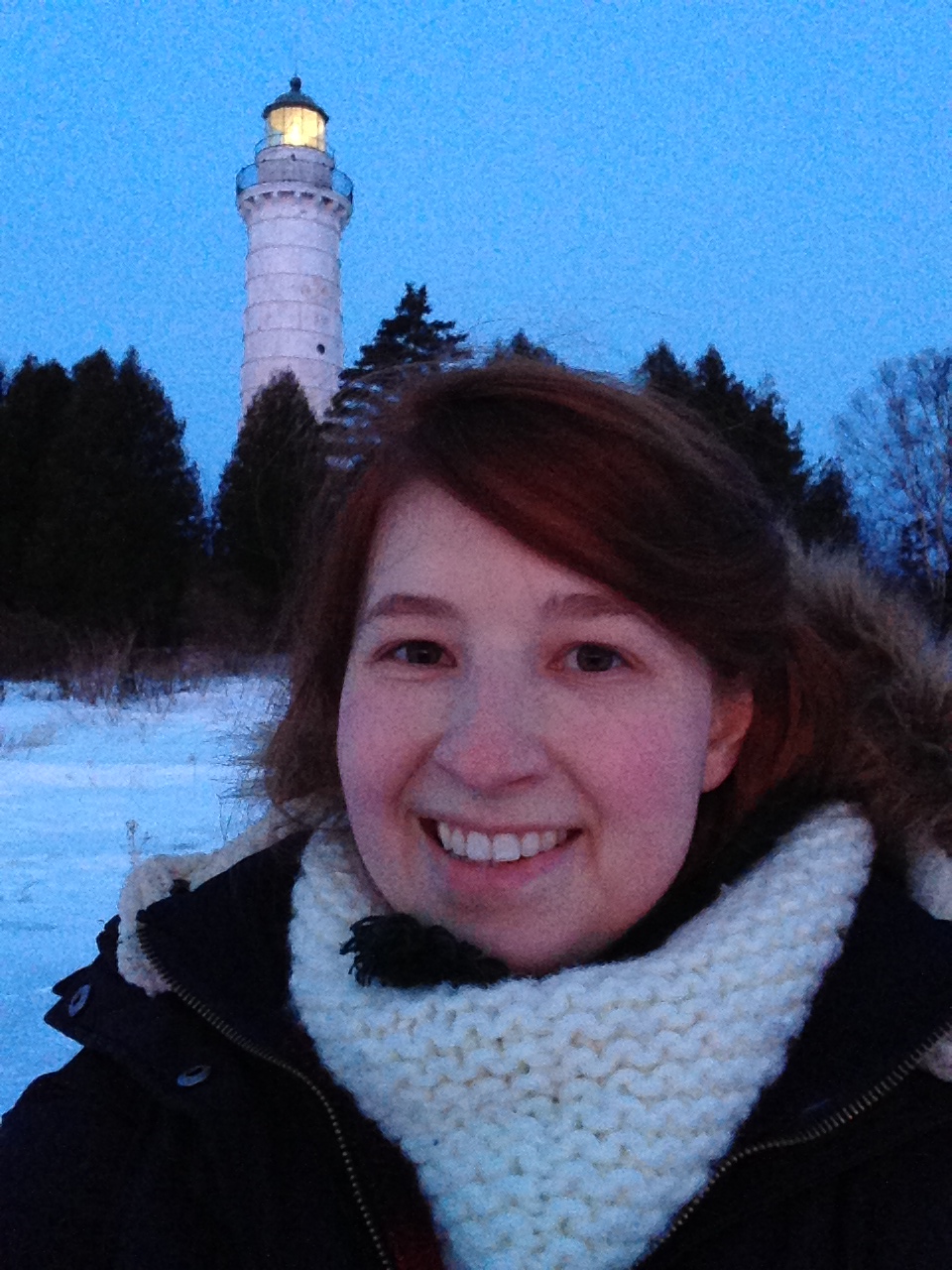
Once we were happy with the images at Cave point we decided to head out to Bailey’s Harbor to photograph the Cana Island lighthouse. By the time we arrived it was close to noon so the lighting wasn’t ideal. The lighthouse is sort of tucked away and the road to get there is heavily wooded and rural. The lighthouse is on an island which is connected to the mainland by a rocky channel which at times can be covered with 1-2 feet of water. The lighthouse itself was first lit in 1870 and stands 89 feet tall. Angela wanted to come back the following day for sunrise photos to take more images of the lighthouse but with the light on. We didn’t stay very long here because we figured the light would be better the next morning.
The first two stops were the only planned locations in the area that we wanted to visit. We had plans to go to Peninsula State park for sunset photos and didn’t want to head that direction until it was later in the day. We looked at our maps for interesting places to go and I stumbled on a park called Door Bluff Headlands County Park. The park is the most northerly point of the door county peninsula. Apparently, the park is undeveloped aside from the road to the entrance of the park which we did not know at the time. The area is said to be the place where the Potawatomi Indians fought the Iroquois Indians over Washington Island. We weren’t sure what to expect as there wasn’t much out on the internet about the park. This makes sense now, considering it isn’t developed. There was a car already in the parking area. We were just about to get our snow shoes on when we noticed the owner of the other car heading back in from the trail. He was a very nice man who was also photographing. We asked if the trail was very long and if there were any ice shoves or interesting things to photograph. He warned that the way down was pretty easy but the way up was a bit more difficult but that snow shoes would make it much easier. He had limited gear on and what looked like ordinary hiking boots. He took off and we decided to make our way into the trail.
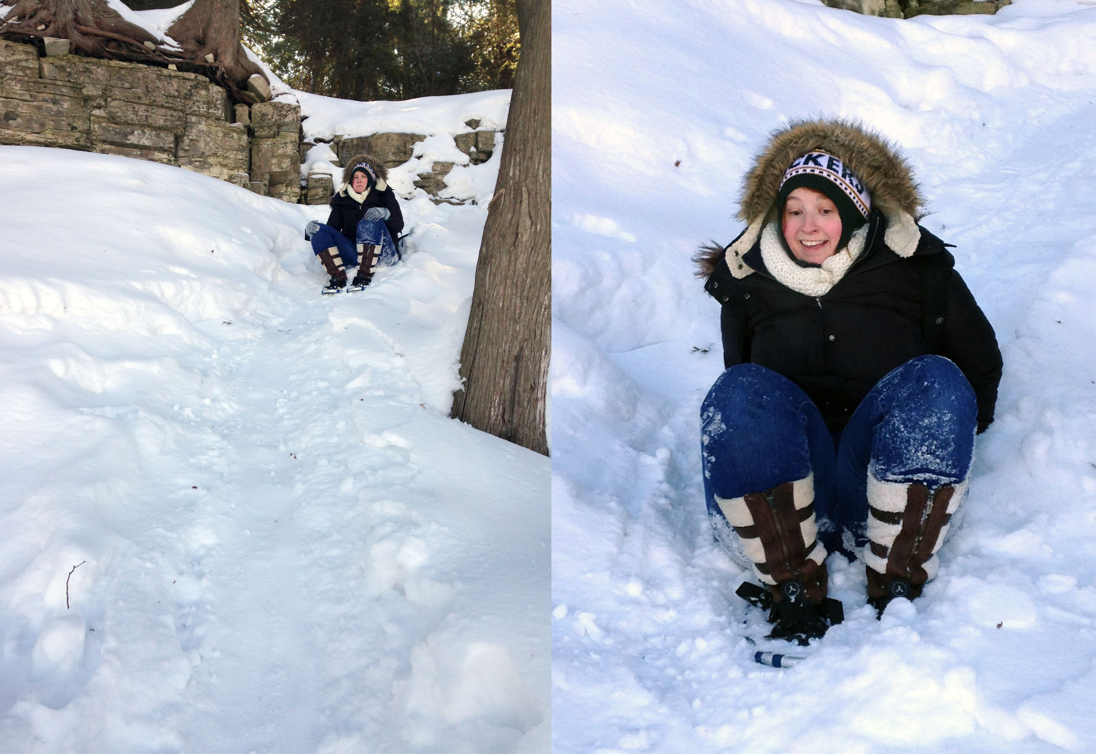
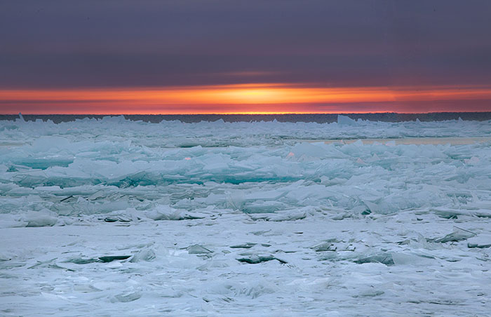
The hike in was at least a mile before it began to descend to the shore line of the bay. We quickly realized that the gentleman hiker was being very modest about the trail as we slowly edged our way down the trail. Even with snow shoes we were slipping and sliding from the steep decline. Eventually we decided it would be easier and faster to just “butt sled” down the rest of the way. Angela almost flew off the trail at one point but luckily she caught a nearby tree to help guide her back on course. You can see in the photos below a picture of me “butt sledding” down the trail. Once we finally reached the shore it was all worth it. There were beautiful deep glacier and aqua blue ice formations close enough to walk up to. I was ecstatic considering the other ice shoves were too far away and treacherous at Cave point. We were still a little nervous because you never know how thick the ice is and what is below the snow, but we stuck to where there were clear foot prints and made our way to the icy mountains. I wanted to get a vantage point of the tops of the ice formations so I decided to climb it. This probably wasn’t the safest decision I’ve ever made but totally worth it. Angela was kind enough to take a picture of me standing on top and it really looks like I am in the arctic someplace.
I was dreading the idea of going back up the trail because going down was difficult enough. The guy we met either didn’t take the same path as us or is just a beast of a hiker because the trek up was extremely difficult. My snowshoes had the metal picks in the middle, rather than on the front so I had basically no traction to get up the incline. I had to literally shove my knees into the snowy ice and rock and claw my way up, using whatever tree branch or rock outcropping I could find to help me up the pitch. It was basically like extreme winter free rock climbing but add an entire back pack full of photo gear and a tripod. Did I mention that I have asthma and had the brilliant idea of leaving my inhaler in the car? We finally made it back to the top, exhausted but proud. Angela is much more fit than I but we both agreed that it was one of the harder trails we had been on and grumbled about the man who was so nonchalant about its difficulty. We ate lunch there, again in effort to keep the trip cheap we packed most of our food so we could eat on the go and have healthy options. It was nice to sit and eat outside. I could feel the cold air deep in my lungs and felt a twinge of wheeziness in my chest from the hike so I took a few puffs on my inhaler. I knew my knees would be covered in bruises as they already started to ache when I moved. Bruised but not broken, we got back in the car for the next adventure.
Peninsula State park was our next stop and a bit of a drive from where we were. Our plan was to hike around for a while and then make our way to the lighthouse to take sunset photos. We got to the park and quickly realized that the only way to the lighthouse was on a snowmobile trail. All of the other hiking or snowshoe trails fell along areas we were not interested in photographing. We didn’t want to risk going on the snowmobile trails and the park ranger cautioned us that we could go on the trail, but that it was dangerous and not recommended. We were really disappointed but decided to stay safe and just skip it. Now that our sunset photo-op was moot, we had to search for a new location. There was a really neat Chapel nearby made of wood and modeled after a chapel in Lillehammer Norway. We got a quick shot of the chapel but had to leave as a tour group came through. We saw that there was another lighthouse somewhat nearby. We drove there and found a road that could only be accessed by foot. We didn’t see the lighthouse so we figured it was further in on the path. Turns out that lighthouse didn’t exist. Sunset was quickly approaching and we had no photo opportunity. We decided to just quit while we were ahead and get some dinner. To reward ourselves for the hard work throughout the day and the disappointment of no sunset photos we decided to go get some pizza. It was delicious and it felt nice to have something warm in our bellies. (I should mention that we had some food that we were going to heat up in the microwave, but our microwave in the hotel did not function. We ended up eating our egg muffins cold every morning.) After dinner we went back to the hotel to unwind a bit. I backed up the images I had taken throughout the day to my hard drive and did a quick review of the images.
Our plan was to go to bed early so we could wake up at midnight at head back to Cave Point to take some star trail photos. Once the midnight alarm went off we spent some time hemming back and forth in the dark, both trying to politely indicate that we’d rather sleep. Finally we just went back to bed. We woke up a few hours later to head back to Cana Island for sunrise photos. We got there early enough that the stars were still out. I had some technical issues with my camera so I wasn’t able to get a very good shot before the sun came up. I included the one star trail photo, which isn’t very good but does show how bright Venus was that night. The sunrise was incredible. Lots of deep magenta and purples streaked with red and yellow. It was a very peaceful morning and there was a certain still beauty looking up at the light of the lighthouse shining out onto the shore. After I was satisfied with the lighthouse shots I decided to trek further out on the ice shoves to try to get a few more photos of the ice against the sunrise. We headed back to the hotel to check out and make our way to the very last stop which was Wequiock Falls outside of Green Bay. The Falls were very pretty but I think I was a little burnt out by the time we got there because I didn’t have much creative energy left to photograph. I think I was about ready to go home.
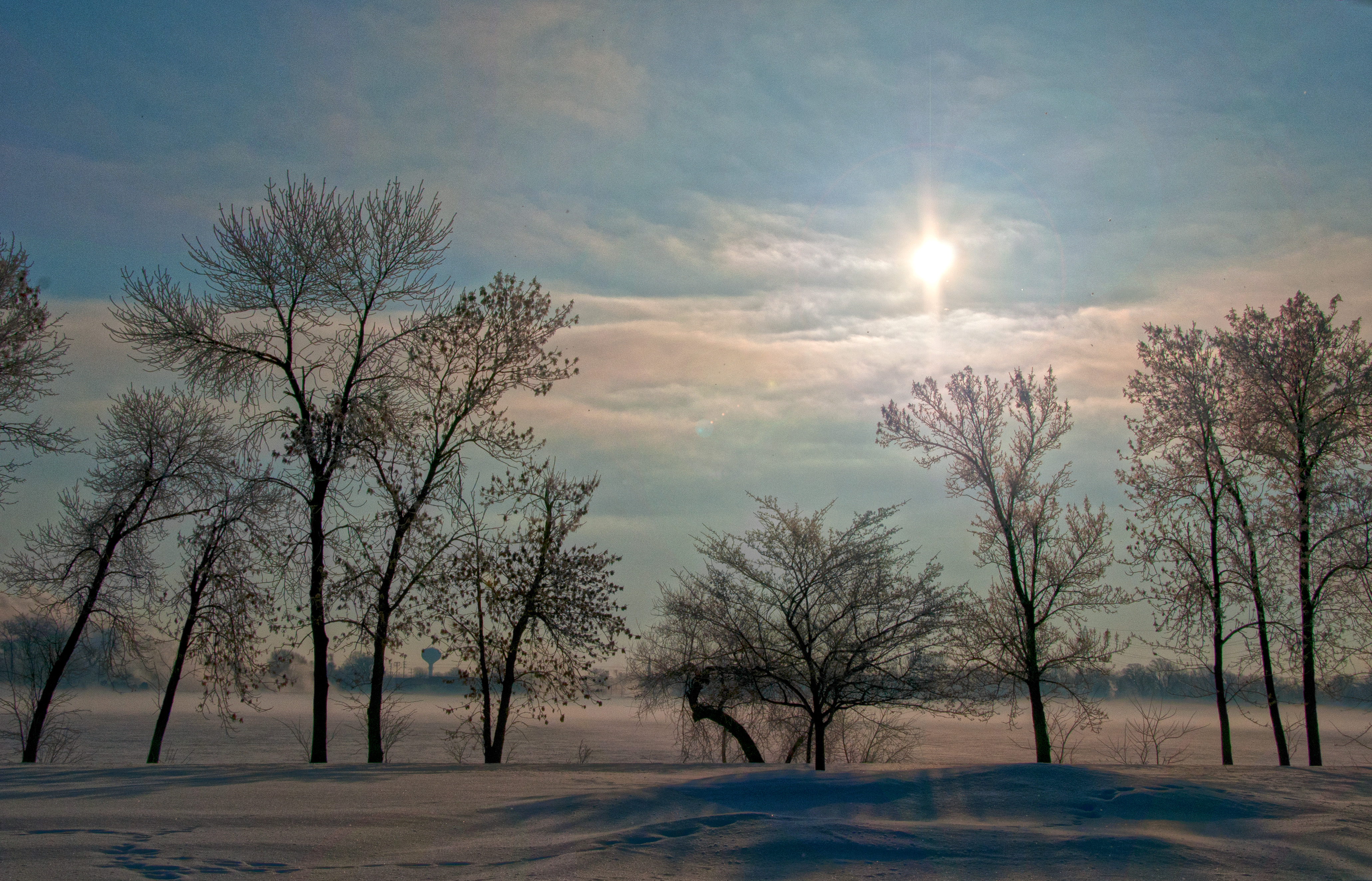
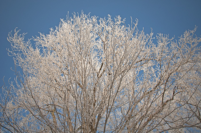
Overall, the trip was a blast. I am so happy with the images I took and can’t wait to visit a few of these places in different season to see how the landscape changes. Hope you all like the images! I also included a few images I took of a hoar frost that came through the valley the day before we left. Thought it was a fitting winter landscape.

I took this as a sign of a prosperous adventure. Spotted him on the side of the road just a short while into the trip
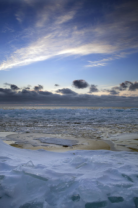
Just before sunrise at Cave Point County Park


It was incredibly windy and cold by the shore. I sat there for about an hour and a half. My cheeks were pretty wind burned by then

The Cana Island Lighthouse just before noon
Navigating trail to the shoreline at Door Bluff Highlands County Park

An idea of how steep the trail is

Beautiful ice shoves created by the wind moving ice onto the shore


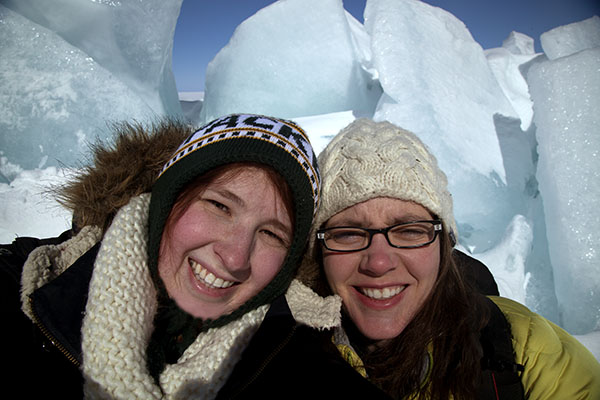

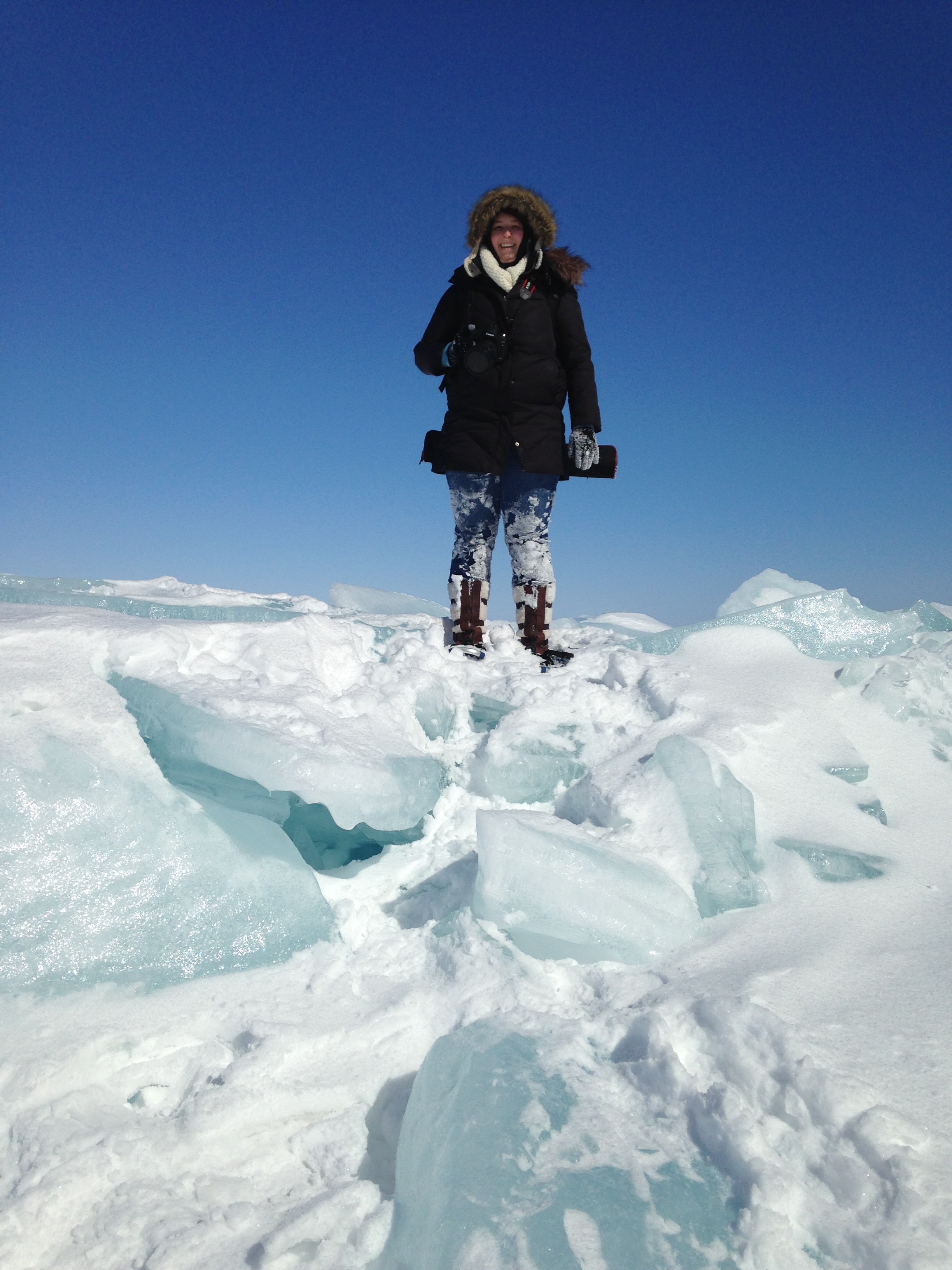
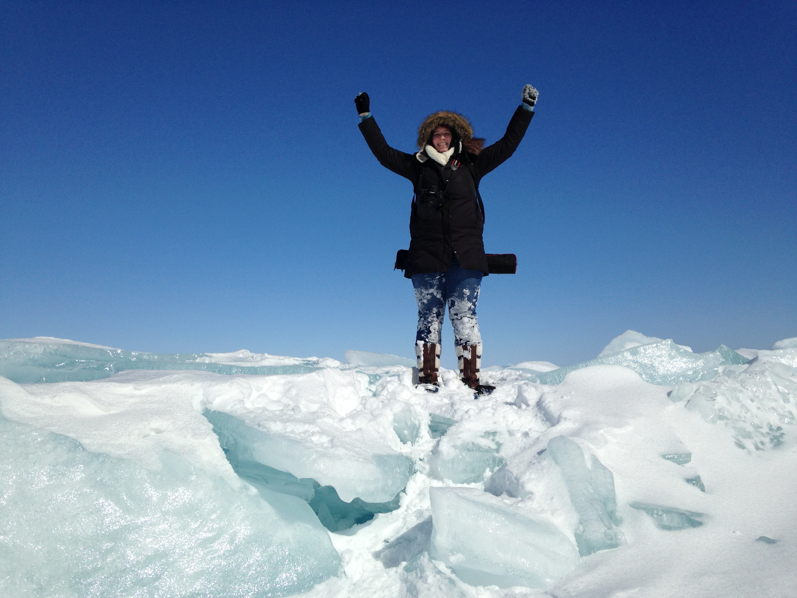
I climbed the ice shove mountains which was not easy, nor entirely safe


Stopped a small cafe for a pick me up after our bear of an adventure at Door Bluff
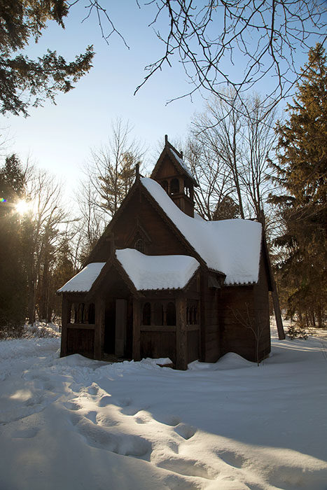
Boynton Chapel

Star trails back at the Cana Island lighthouse
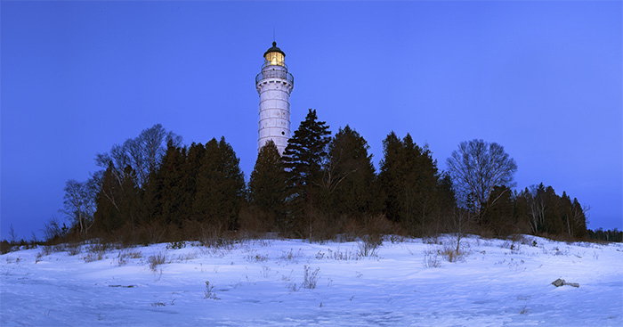
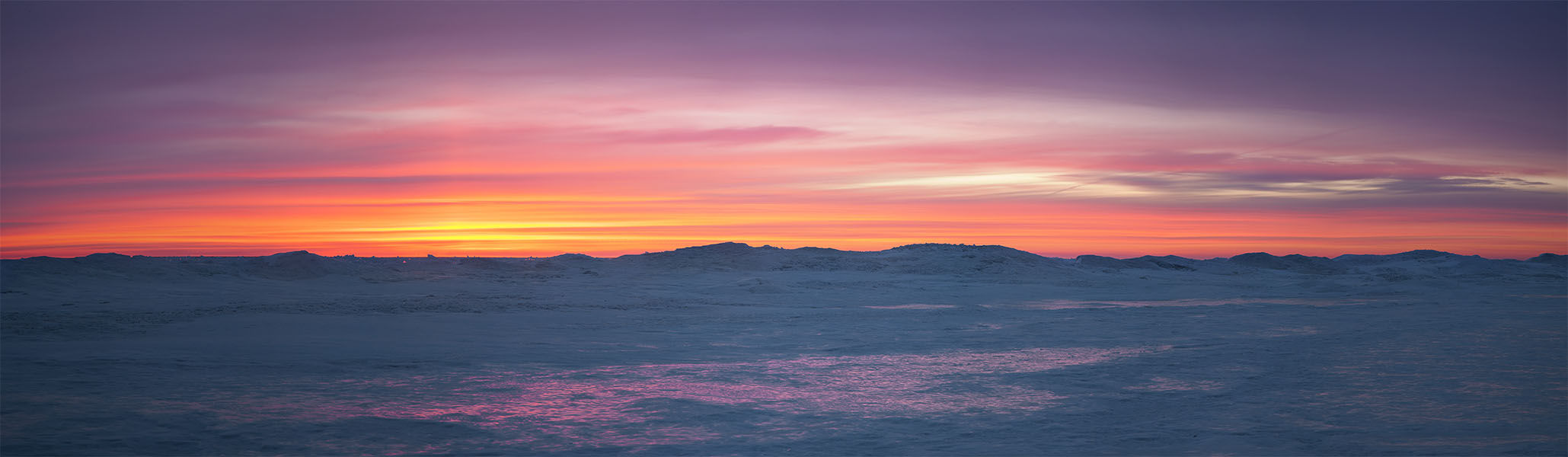
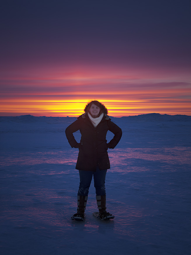
The sunrise at the light house was spectacular. I felt like I was in the arctic.

More ice shoves behind the lighthouse

Wequiock Falls just outside of Green Bay


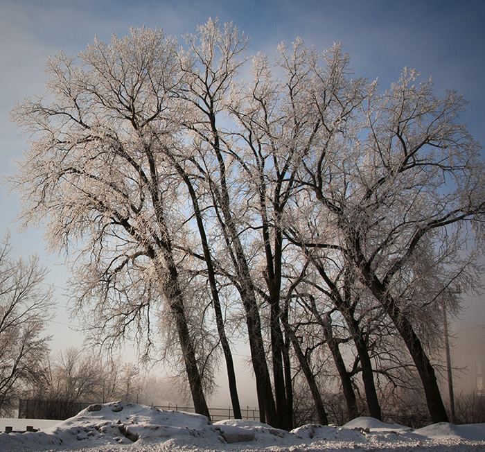
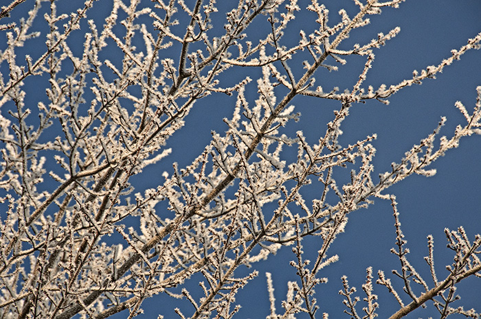
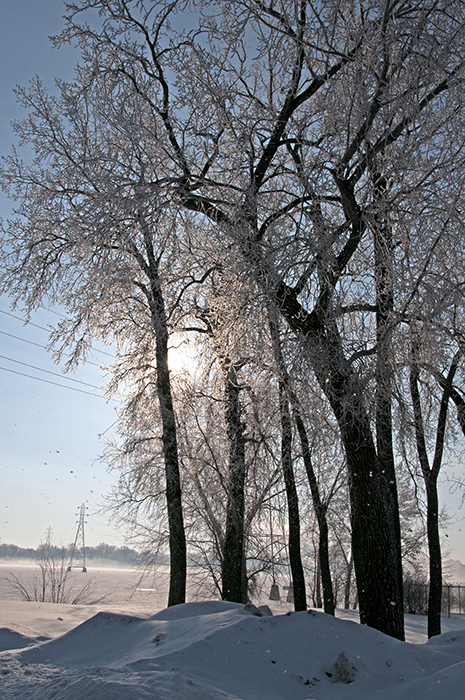
Hoar frost that hit the fox valley a day before we left


Thanks for the story and beautiful photos. I visited Door Bluff County Park yesterday to see the ice shoves. http://www.liquidadventuring.com/2015/03/26/pressure-ridges-or-as-theyre-known-here-ice-shoves/
Thanks for your kind words! That is fantastic you were able to visit! Were the ice shoves still there? We had a bit of a warm up that melted a lot but it has been cold again as of late!
Yes, the ice shoves are certainly there. Very impressive right now and even bigger than last year, according to most reports.